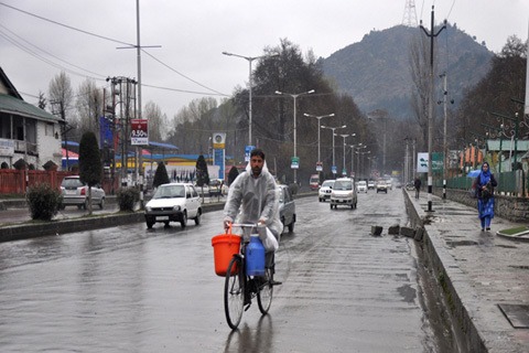

Srinagar: Amid advisory for widespread rains or snow, minimum temperatures increased across Kashmir Valley, officials said on Sunday.
A meteorological department official said that Srinagar recorded a low of 7.4°C against 6.0°C on the previous night. The minimum temperature was 4.7°C above normal for this time of the year in the summer capital of J&K, the official said.
Qazigund, the gateway town of Kashmir, recorded a low of 5.7°C against 4.4°C on the previous night while mercury settled at 0.1°C against minus 0.2°C on the earlier night at Pahalgam, the famous resort in south Kashmir.
Kokernag, also in south Kashmir, recorded a low of 6.0°C against the previous night’s 4.3°C, the official said.
The minimum temperature settled at 5.3°C in Kupwara against 2.8°C on the previous night, the official said.
Gulmarg recorded minimum temperature of 2.0°C against minus 0.5°C on the previous night, the official said. The temperature at the world famous skiing resort which received nearly 3ft fresh snowfall last week is 4.3°C normal for this time of the year, the official said.
The weather office has already issued an advisory regarding widespread rain or snowfall in Jammu and Kashmir.
“In quick succession, two Western Disturbances are most likely to affect J&&K and adjoining areas from 21st March (afternoon),” Dr Mukhtar Ahmad, Sc-C Director/LACD said in an advisory addressed to Divisional Commissioners of Kashmir, Jammu and Ladakh.
“Under the influence of these weather systems, widespread moderate rain/snow is expected in Jammu, Kashmir and light rain/ snow at a few places of Ladakh region on 21st March. (There is) Possibility of thunder/ lightning with hail and gusty winds (30-40 KMPH) at isolated places in Janimu division,” reads the advisory.
Another western disturbance is most likely to affect J&K and neighbourhood from March 22 afternoon with its peak intensity during 22nd night to 23rd night and gradual decrease thereafter, the advisory reads further.
“The system is most likely to cause heavy rain/snow mainly in upper reaches of Kashmir (Gulmarg, Sonamarg, Baramulla, Bandipora (Gurez & Tulail Valley) and Kupwara (Karnah Sector), Shopian, Qazigund-Banihal axis. Pirpanjal Range of Jammu Division, Drass (Gumri & Minamurg) and Zanskar subdivision of ladakh.”
As per the advisory, the probable impacts include “temporary” disruption of surface traffic mainly on Jammu-Srinagar/Srinagar-Leh Highway, Mughal road and other major roads.
There is a possibility of landslides and shooting stones in vulnerable spots of Jammu- Srinagar and Srinagar-Leh Highway, it says.
Possible impacts also include temporary water logging in low lying areas and a dip in day temperature. “Suspend/avoid agricultural and horticultural operations (fertilizer and chemical spray) and drain out excess water.”
Separately, in a daily statement about the forecast, the meteorological department issued a “yellow warning” for isolated thunder/hail/ gusty winds of 30-40 kmph in Kashmir as well as Jammu divisions on March 21 and 22. However, for March 23, the weatherman has issued ‘amber warning’ for “scattered heavy rain/snow/thunder/lightning” with likely disruption in Surface traffic Jammu-Srinagar highway and Srinagar-Leh highway due to landslides and waterlogging in low laying area.”
On March 24, there is no warning but the weatherman said that there may be disruption in surface traffic on both highways due to landslides.”
Free Press Kashmir is now on Telegram. Click here to Join.
FPK Android App for 2G. Click here to Download.