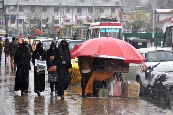

Srinagar: Weatherman has forecast light to moderate thundershowers with rain and lightning over Poonch, Rajouri, Shopian, Gulmarg, Uri, Tangdar and south Kashmir districts during the next 2-3 hours.
A Meteorological official on Friday said that the same weather was most likely to continue for the next few days. “There’s no forecast of any major rainfall for the next few days. We expect slight relief from scorching heat wave in both Jammu and Kashmir region from today.”
Regarding Ladakh, the officials said that the weather will remain partly to generally cloudy throughout the region. “No forecast of any significant Weather in coming days,” he added.
Meanwhile, The India Meteorological Department (IMD) has predicted heavy rainfall on Friday in several areas of the country as it said a low-pressure area has formed over the northwest Bay of Bengal and adjoining Odisha as well as Gangetic West Bengal coasts.
The weather bureau forecast heavy to very heavy rainfall is very likely at a few places with extremely heavy rains at isolated places over Chhattisgarh and Odisha.
“Heavy to Very Heavy Rainfall at a few places over Konkan and Goa and at isolated places over East Madhya Pradesh, Vidarbha and Coastal Andhra Pradesh and Yanam and Heavy Rainfall at isolated places over Uttarakhand, Uttar Pradesh, West Madhya Pradesh, Gangetic West Bengal, Andaman and Nicobar Islands, Assam and Meghalaya, Gujarat Region, Madhya Maharashtra (ghat areas), Telangana and Coastal Karnataka,” the Met department also said in a bulletin on Thursday.
Most of east India and adjoining central India is likely to witness fairly widespread to widespread rainfall activity with isolated to scattered heavy to very heavy fall from Friday under the influence of the low pressure over the northwest Bay of Bengal and adjoining Odisha and Gangetic West Bengal coasts.
The IMD said it is likely to become more marked during the next 24 hours and move west-northeastwards across Odisha.
Conditions are favourable for further advance of southwest monsoon into more parts of Gujarat, Madhya Pradesh, remaining parts Chhattisgarh and Odisha, entire West Bengal and Jharkhand and parts of Bihar and east Uttar Pradesh and remaining parts of north Bay of Bengal during the next 24 hours, according to the weather bureau.
“Due to the strengthening of westerly winds along the west coast in association with the low-pressure area; widespread rainfall activity with heavy to very heavy falls likely to continue over coastal districts of Maharashtra during 11th to 15th June and likely over coastal Karnataka during 12th to 15th June, 2021. Isolated heavy rainfall is very likely over Kerala during 12th to 15th June 2021. Isolated extremely heavy falls also very likely over Konkan during 12th to 15th June 2021,” IMD said.
Uttarakhand, Punjab, Haryana, Chandigarh, Delhi, Uttar Pradesh, Bihar, Jharkhand and Telangana are likely to witness thunderstorms with lightning and gusty winds (speed reaching 30-40kmph) at isolated places. Lightning at isolated places over Jammu and Kashmir, Ladakh, Gilgit Baltistan and Muzaffarabad, Himachal Pradesh, Madhya Pradesh, Vidarbha, Chhattisgarh, West Bengal, Sikkim, Andaman and Nicobar Islands, Assam, Meghalaya, Nagaland, Manipur, Mizoram, Tripura, coastal Andhra Pradesh, Yanam, coastal Karnataka and Kerala and Mahe.
Free Press Kashmir is now on Telegram. Click here to Join.
FPK Android App for 2G. Click here to Download.