“When the army surrounds us from everywhere, where would the people go?” asks a teary eyed shopkeeper from Bemina. Standing in a shabby shop which sells all sorts of essentials for daily life, Mohammad Amin recalled the horrid experience of the flood in 2014 which consumed almost every part of Srinagar and nearly destroyed the abode of this middle aged man.
With a long wooden stick he pointed out the level till which the water had risen in his shop.
“We have no other option but to walk the narrow path that we are pushed towards,” commented the said person while handing out biscuits, chocolates, cigarettes or whatever was demanded by the non-stop flow of customers.
Ignoring the suspicious looks and random questions by passersby, thanks to my very Indian looking face, I asked Mr. Amin to elaborate on his comments.
The eager to explain shopkeeper, took out a scrap of yellow paper from a stack of neatly arranged notebooks. He started drawing and explaining.
The circle he drew, depicted Srinagar and the straight lines around the circle, sticking like needles on a soft ball was an obvious representation of the Indian army. And amidst these pointed needles-sucking the life out of the city-was a narrow path through where the tiny dots of Kashmiris were seemingly trying to escape.
This was a depiction of the land occupied by the Indian army. An occupation of physical spaces in the city of Srinagar which made the original occupants of these material spaces, to find someplace else to make a home. And people did.
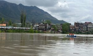
With higher ground dotted with army camps and military facilities, with horrifying structures and barb wires, the expansion of the city happened in the reverse direction into the wetlands and flood plains.
Houses were built in the marshy zones like Bemina, and over agricultural land like Hyderpora, while the army occupied most of the elevated lands in the city.
For example, the Badami Bagh cantonment by the Srinagar-Jammu highway is the first thing one would notice while entering the Srinagar city.
Built at a height of 1,727 meters, the cantonment boasts of safety while the population of Bemina, Batmaloo, Qamarwari among other areas are forced to find shelters for themselves amidst danger and risk every time it rains.
The bright red and white walls of Badami Bagh Cantonment as opposed to the mellow colours of shops and buildings in the area, are a grim reminder of dominance and enforcement. The high barbed wires of the said cantonment symbolic.
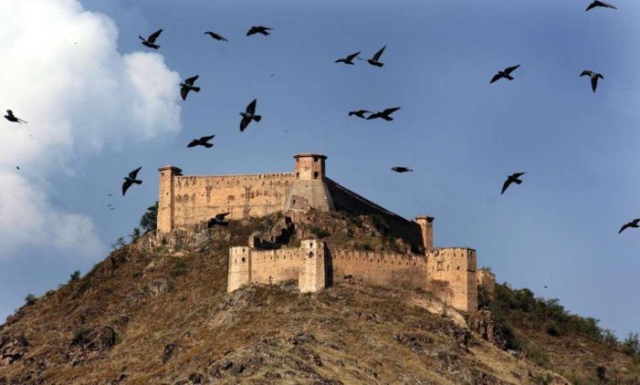
This symbolism has been in place since the Mughals according to Dr. Saleem Beg, INTACH Convener, Kashmir Chapter . He argues that the Parimahal was built by Mughals as a showcase of their presence in Kashmir. Similarly the occupation of all the elevated areas in Srinagar by the Indian army is a symbolism.
Anyone familiar with military strategy will know that elevated lands are advantageous positions for armies. But to treat the people of Kashmir as disposable by encroaching on their lands and pushing them towards disaster prone zones, leaving them to fend for themselves is a chilling revelation of the worth of human lives. These ‘unworthy victims’ pushed into disaster need a ‘savior’ for public relations purposes, never mind how the danger was bought upon the victims in the first place.
“The concern of flood was out of the public memory when the first Master Plan was put in action in 1974,” informs Dr. Beg when questioned about whether there was any risk assessment done by the government before letting people build houses in wet lands.
Citing the example of Jawahar Nagar, the urban planner explained that it was a marshy land previously. During monsoons, the area would be flooded. However, gradually the land was covered and houses were constructed because higher ground was taken over. Hence the disaster of 2014. “The water went to the place it was supposed to go. Only now, it consumed houses instead of marshes.”
Why are houses built on previous marshes and why didn’t the city grow towards the elevated lands? One familiar with the politics of Kashmir will not need to think twice before coming to the obvious conclusion.
“Is the new masterplan of 2020 thinking about flood and the absence of lands?”
“They are talking, not thinking. All these are rhetorical talks.”
“Why?”
“Because they don’t matter!”
‘They’ are the Kashmiris. The disposable population. The people whose political status and their right to life has been reduced to crumbs. The people whose right to city has been snatched.
They, the creator of chaos and disorder. They, perceived to threaten stability, order and ‘life security’. They, the spectre haunting the mighty Indian state. They are the victim and survivors of India’s necro-power. They are the ultimate resistance to the regime’s necro-politics.
Propounded by the Cameroonian philosopher, political theorist, and public intellectual Achille Mbembe, necropolitics talk about how a regime or a sovereign state has a right to kill its disposable population.
The population, it thinks is not worth living.
The same theory and means are applicable to Kashmir. The state wants the space, without the population. Space is compartmentalized. Boundaries and frontiers are created and epitomised by military barracks and police compounds, and regulated by the language of force, presence, and frequent action.
Any form of resistance ends in suppression, servitude and death.
However, there are more than one ways to marginalize a ‘disposable’ population. Urban planning is one of them.
There is a longstanding debate in the development discourse regarding the actual use of urban planning. Is it to make lives better or is it a form of social control? Academicians like Engels, Yiftachel, Mbembe, Willis etc., have argued for the later. That it is a form of social control. To relegate certain zones for certain purposes, to build gated communities, to push the “others” from the public view and to hope for the erasure of them from public memory-are all embedded in urban planning.
The absence of the concern of floods from ‘public memory’ during the first master plan can’t help but raise a red flag.
The rhetorical talks of the risk of floods and not real concern, in the new master plan is an open indication of the intention of the government to erase the population, metaphorically and literally.
To make them the victim of another disaster, to put them in danger in the name of urban planning, to dispose them off.
The state and central government are also increasing the size of Srinagar. They are doubling the area under the new master plan.
“It is just to manage the population. Nothing else,” says Dr. Beg.
So the new master plan is to survey the areas which are still unmanageable by the Indian armed forces, and all will be done under the garb of planning, development, progress, modernisation and various other jargon.
Any resistance to it will mean that Kashmiris don’t want progress. The general Indian public will emote against these Kashmiris together as regressive.
There will be the ‘collective conscience’ asking for more killings, more harassment, more oppression. The Indian state in Kashmir derives its legitimacy from this ‘collective conscience’. And the mayhem will continue while the necropolitics of the Indian state will win again.
Utsa Sarmin is a research scholar from Cambridge University, United Kingdom. She has completed her M.Phil in development studies.


“When the army surrounds us from everywhere, where would the people go?” asks a teary eyed shopkeeper from Bemina. Standing in a shabby shop which sells all sorts of essentials for daily life, Mohammad Amin recalled the horrid experience of the flood in 2014 which consumed almost every part of Srinagar and nearly destroyed the abode of this middle aged man.
With a long wooden stick he pointed out the level till which the water had risen in his shop.
“We have no other option but to walk the narrow path that we are pushed towards,” commented the said person while handing out biscuits, chocolates, cigarettes or whatever was demanded by the non-stop flow of customers.
Ignoring the suspicious looks and random questions by passersby, thanks to my very Indian looking face, I asked Mr. Amin to elaborate on his comments.
The eager to explain shopkeeper, took out a scrap of yellow paper from a stack of neatly arranged notebooks. He started drawing and explaining.
The circle he drew, depicted Srinagar and the straight lines around the circle, sticking like needles on a soft ball was an obvious representation of the Indian army. And amidst these pointed needles-sucking the life out of the city-was a narrow path through where the tiny dots of Kashmiris were seemingly trying to escape.
This was a depiction of the land occupied by the Indian army. An occupation of physical spaces in the city of Srinagar which made the original occupants of these material spaces, to find someplace else to make a home. And people did.
With higher ground dotted with army camps and military facilities, with horrifying structures and barb wires, the expansion of the city happened in the reverse direction into the wetlands and flood plains.
Houses were built in the marshy zones like Bemina, and over agricultural land like Hyderpora, while the army occupied most of the elevated lands in the city.
For example, the Badami Bagh cantonment by the Srinagar-Jammu highway is the first thing one would notice while entering the Srinagar city.
Built at a height of 1,727 meters, the cantonment boasts of safety while the population of Bemina, Batmaloo, Qamarwari among other areas are forced to find shelters for themselves amidst danger and risk every time it rains.
The bright red and white walls of Badami Bagh Cantonment as opposed to the mellow colours of shops and buildings in the area, are a grim reminder of dominance and enforcement. The high barbed wires of the said cantonment symbolic.
This symbolism has been in place since the Mughals according to Dr. Saleem Beg, INTACH Convener, Kashmir Chapter . He argues that the Parimahal was built by Mughals as a showcase of their presence in Kashmir. Similarly the occupation of all the elevated areas in Srinagar by the Indian army is a symbolism.
Anyone familiar with military strategy will know that elevated lands are advantageous positions for armies. But to treat the people of Kashmir as disposable by encroaching on their lands and pushing them towards disaster prone zones, leaving them to fend for themselves is a chilling revelation of the worth of human lives. These ‘unworthy victims’ pushed into disaster need a ‘savior’ for public relations purposes, never mind how the danger was bought upon the victims in the first place.
“The concern of flood was out of the public memory when the first Master Plan was put in action in 1974,” informs Dr. Beg when questioned about whether there was any risk assessment done by the government before letting people build houses in wet lands.
Citing the example of Jawahar Nagar, the urban planner explained that it was a marshy land previously. During monsoons, the area would be flooded. However, gradually the land was covered and houses were constructed because higher ground was taken over. Hence the disaster of 2014. “The water went to the place it was supposed to go. Only now, it consumed houses instead of marshes.”
Why are houses built on previous marshes and why didn’t the city grow towards the elevated lands? One familiar with the politics of Kashmir will not need to think twice before coming to the obvious conclusion.
“Is the new masterplan of 2020 thinking about flood and the absence of lands?”
“They are talking, not thinking. All these are rhetorical talks.”
“Why?”
“Because they don’t matter!”
‘They’ are the Kashmiris. The disposable population. The people whose political status and their right to life has been reduced to crumbs. The people whose right to city has been snatched.
They, the creator of chaos and disorder. They, perceived to threaten stability, order and ‘life security’. They, the spectre haunting the mighty Indian state. They are the victim and survivors of India’s necro-power. They are the ultimate resistance to the regime’s necro-politics.
Propounded by the Cameroonian philosopher, political theorist, and public intellectual Achille Mbembe, necropolitics talk about how a regime or a sovereign state has a right to kill its disposable population.
The population, it thinks is not worth living.
The same theory and means are applicable to Kashmir. The state wants the space, without the population. Space is compartmentalized. Boundaries and frontiers are created and epitomised by military barracks and police compounds, and regulated by the language of force, presence, and frequent action.
Any form of resistance ends in suppression, servitude and death.
However, there are more than one ways to marginalize a ‘disposable’ population. Urban planning is one of them.
There is a longstanding debate in the development discourse regarding the actual use of urban planning. Is it to make lives better or is it a form of social control? Academicians like Engels, Yiftachel, Mbembe, Willis etc., have argued for the later. That it is a form of social control. To relegate certain zones for certain purposes, to build gated communities, to push the “others” from the public view and to hope for the erasure of them from public memory-are all embedded in urban planning.
The absence of the concern of floods from ‘public memory’ during the first master plan can’t help but raise a red flag.
The rhetorical talks of the risk of floods and not real concern, in the new master plan is an open indication of the intention of the government to erase the population, metaphorically and literally.
To make them the victim of another disaster, to put them in danger in the name of urban planning, to dispose them off.
The state and central government are also increasing the size of Srinagar. They are doubling the area under the new master plan.
“It is just to manage the population. Nothing else,” says Dr. Beg.
So the new master plan is to survey the areas which are still unmanageable by the Indian armed forces, and all will be done under the garb of planning, development, progress, modernisation and various other jargon.
Any resistance to it will mean that Kashmiris don’t want progress. The general Indian public will emote against these Kashmiris together as regressive.
There will be the ‘collective conscience’ asking for more killings, more harassment, more oppression. The Indian state in Kashmir derives its legitimacy from this ‘collective conscience’. And the mayhem will continue while the necropolitics of the Indian state will win again.
Utsa Sarmin is a research scholar from Cambridge University, United Kingdom. She has completed her M.Phil in development studies.
Recommended for you